Pages

Monday 29 June 2020

SWCP Day 36: This is the land of my content

Other SWCP posts:

Introduction
Day 1: Minehead to Porlock
Day 2: Porlock to Lynton
Day 3: Lynton to Combe Martin
Day 4: Combe Martin to Mortehoe
Day 5: Rest day, Morte Point loop
Day 6: Mortehoe to Braunton
Day 7: Braunton to Westward Ho!
Day 8: Westward Ho! to Clovelly
Day 9: Clovelly to Hartland Quay
Day 10: Hartland Quay to Morwenstow
Day 11: Morwenstow to Bude
Days 12-14: Bude to Crackington Haven
Day 15: Crackington Haven to Tintagel
Day 16: Tintagel to Port Isaac
Day 17: Port Isaac to Padstow
Day 18: Padstow to Porthcothan
Day 19: Porthcothan to Crantock
Day 20: Rest day, Holywell bay loop
Day 21: Crantock to St Agnes
Day 22: St Agnes to Godrevy
Day 23: Godrevy point to St Ives
Day 24: St Ives to Pendeen Watch
Day 25: Pendeen Watch to Sennen Cove
Day 26: Sennen Cove to Lamorna
Day 27: Lamorna to Marazion
Day 28: Marazion to Porthleven
Day 29: Porthleven to Lizard Point
Day 30: Lizard Point to Coverack
Day 31: Rest day in Coverack
Day 32: Coverack to Maenporth

Days 37-39: Polkerris to Fowey

Day 40: Polruan to Polperro

Day 41: Polperro to Seaton

Day 42: Seaton to Kingsand

Day 43: Kingsand to Plymouth


Day 36

Pentewan to Polkerris

Approx. 11.5 miles, 750m ascent

27,519 steps


After a restful night on the very quiet campsite I breakfasted with the Grandparents, then they deposited me back to the path at Pentewan. A steep hill along a road and I was soon back on the path proper, the first section dipping in and out of several small valleys and skirting pretty sandy bays. I rounded a corner and was surprised to find a small badger rooting around in the long grass alongside the path. I slowly approached, expecting it to take off at any moment, but it didn’t make a move until I was within a couple of metres and wished it a good morning. It looked up with very little concern, then slipped through the fence and bumbled quietly along in the field next to the path. 


Sunny morning walking

Hello little badger!

Not quite bored of pretty little beaches yet


At Black head the cone-shaped hill looked like the perfect spot for the ancient hill fort that the OS map tells me is positioned there, and was faced by somewhat monolithic and interesting memorial to the author and historian A.L. Rowse. I’m not really familiar with his work, but I do like the line on the stone “This was the land of my content”.


AL Rowse memorial


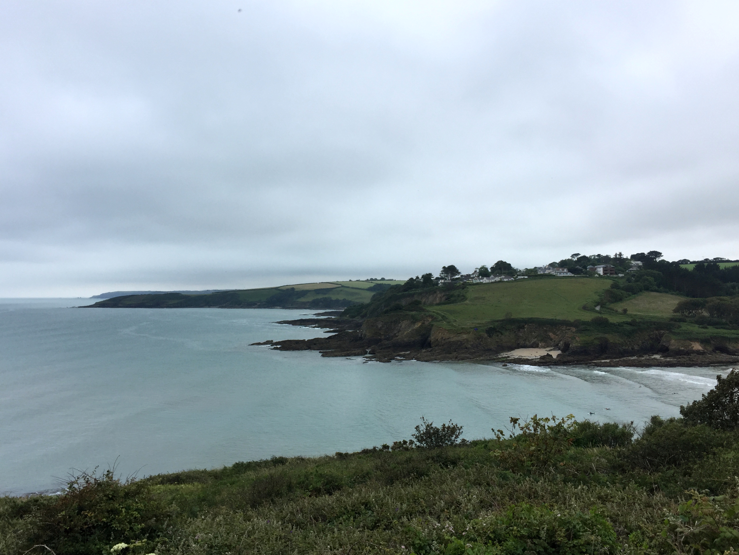
The path turned the corner and I had a full view across the expansive St Austell bay, looking across to my final destination for the day. Quite the expanse of coast to cover first though! The path followed high wooded cliffs for a stretch, then found several more small valleys to keep the legs awake. The path dropped right down to the beaches at Porthpean and Du Porth, clearly favoured locations for outdoor ed activities, as there were several groups of kids enjoying kayaking and splashing around in the bay.


Looking across St Austell bay to Gribbin head and beyond


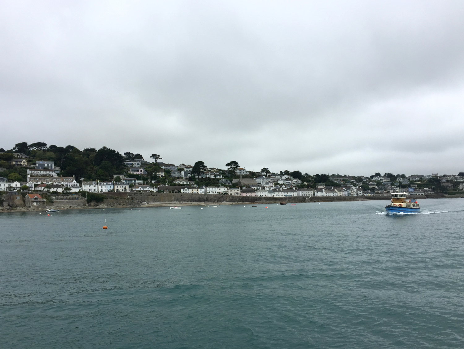
At the touristy Charlestown I admired the tall ship docked in the Georgian harbour, then escaped the very busy town centre and found a quieter but lovely cafe for lunch. It had a very pleasant terrace out the front, so I was able to spread out and remove my steaming boots without alarming any other customers. I had an excellent lunch including a sizeable piece of cake, and felt much better for the afternoon walking, having failed to take proper lunch stops for the last couple of days. 


Charlestown harbour


On my way out of town I bought the usual pasty for my dinner, then found my way around the harbour and back to the path. The next section followed the edge of the seemingly never-ending Carlyon bay golf course; always fun when a footpath involves golf-ball dodging! I was soon on the industrial outskirts of Par, and was grateful to some locals who pointed me down the unappealing official route, saving me having to double back on myself. The path followed the edge of the big china clay works, then along the railway line and followed the road through Par. I made a brief stop off at a grocer for some cherries (suddenly craving fresh fruit after too many pasties) and was pleased to soon be back to more appealing surroundings at Par beach.


The little harbour at Polkerris


Just a short section left along low cliffs and I was in sight of the lovely little cove at Polkerris, yet another place I had previously visited, with some friends the summer before. As I had made decent time I decided to sit and enjoy a half pint outside the pub, followed by a (very brief!) dip in the cold sea. I then found my way up the hill to the campsite at Penhale farm, harassed on the way by some hungry horseflies, which I sped up to avoid. I was soon enjoying the very quiet campsite, with a nice sheltered pitch just a short way from the facilities. 

Monday 22 June 2020

SWCP Day 35: Strawberries and cream

Other SWCP posts:

Introduction
Day 1: Minehead to Porlock
Day 2: Porlock to Lynton
Day 3: Lynton to Combe Martin
Day 4: Combe Martin to Mortehoe
Day 5: Rest day, Morte Point loop
Day 6: Mortehoe to Braunton
Day 7: Braunton to Westward Ho!
Day 8: Westward Ho! to Clovelly
Day 9: Clovelly to Hartland Quay
Day 10: Hartland Quay to Morwenstow
Day 11: Morwenstow to Bude
Days 12-14: Bude to Crackington Haven
Day 15: Crackington Haven to Tintagel
Day 16: Tintagel to Port Isaac
Day 17: Port Isaac to Padstow
Day 18: Padstow to Porthcothan
Day 19: Porthcothan to Crantock
Day 20: Rest day, Holywell bay loop
Day 21: Crantock to St Agnes
Day 22: St Agnes to Godrevy
Day 23: Godrevy point to St Ives
Day 24: St Ives to Pendeen Watch
Day 25: Pendeen Watch to Sennen Cove
Day 26: Sennen Cove to Lamorna
Day 27: Lamorna to Marazion
Day 28: Marazion to Porthleven
Day 29: Porthleven to Lizard Point
Day 30: Lizard Point to Coverack
Day 31: Rest day in Coverack
Day 32: Coverack to Maenporth

Days 37-39: Polkerris to Fowey

Day 40: Polruan to Polperro

Day 41: Polperro to Seaton

Day 42: Seaton to Kingsand

Day 43: Kingsand to Plymouth


Day 35

Boswinger to Pentewan

Approx. 9 miles, 500m ascent

21,615 steps


I made the most of the youth hostel luxury and had a decent lie in, followed by a good-sized cooked breakfast to get me fuelled up for the morning. My feet were still very painful, but it would be quite a short day of walking, followed by a night of caravan luxury with the Grandparents, as they had offered to accommodate me once again whilst they were on a site close to my place on the path.


Back to the path

I eventually got myself moving, feeling very sluggish as I made my way back down the hill (this time taking the proper road!). I re-joined the path at Hemmick beach, and slowly made my way out to the prominent Dodman point. The views were spectacular from the headland, far-reaching back the way I had come and on towards St Austell bay. I took a 20 minute break and enjoyed the peaceful spot, and felt a bit more alive and invigorated when I carried on, helped by a gentle clifftop path until the next headland and Gorran Haven.


Cliff ponies
Hemmick beach

At Gorran Haven I found a bakery that seemed to be doubling as a post office, so I replenished my cash and got a pasty for my lunch stop. There was a cafe in the village but it looked a bit busy so I decided to forego another round of caffeine and crack on. I carried on around the next bay, following the cliff edge as the path dropped down and around Turbot point. Just as I turned the corner of the small headland I spotted a seal resting on a rock a few metres out to sea. It seemed entirely unconcerned by my presence, so I settled down to eat my pasty and quietly watch it (unfortunately the phone camera couldn’t quite capture it!).


Bow beach
Looking back towards Boswinger

Onwards, and I was soon passing through the pretty little village of Portmellon, the shutters on the beachside houses indicating they saw some slightly more dramatic weather than the current calm and slightly overcast day. A half-mile or so up hill following roads and I dropped down into the fishing village of Mevagissey, quite busy with visitors even on a Monday out of the school holidays. I found a promising looking harbourside cafe and refuelled with a milkshake and a piece of cake, enjoying the entertainments of the busy harbour.


Mevagissey
Mevagissey harbour

Suitably refreshed, I climbed the hill out of the village to some phone signal, and let my Grandad know I would be in Pentewan shortly. I perhaps slightly underestimated how much longer I would be, as the path took in a couple of deep valleys in the last mile, but I was soon following the road tracing the gigantic caravan park, and managed to find Grandad just as he was pulling into the carpark.


The last stretch towards the caravan park at Pentewan

We headed away from the rows and rows of static vans to their much nicer and smaller caravan site near the lost gardens of Heligan, and after making the most of the very fancy site facilities I was thoroughly spoiled with a big dinner of steak, followed by strawberries and cream whilst we enjoyed the opening day of Wimbledon.

Thursday 18 June 2020

SWCP Day 34: Slow Sunday

Other SWCP posts:

Introduction
Day 1: Minehead to Porlock
Day 2: Porlock to Lynton
Day 3: Lynton to Combe Martin
Day 4: Combe Martin to Mortehoe
Day 5: Rest day, Morte Point loop
Day 6: Mortehoe to Braunton
Day 7: Braunton to Westward Ho!
Day 8: Westward Ho! to Clovelly
Day 9: Clovelly to Hartland Quay
Day 10: Hartland Quay to Morwenstow
Day 11: Morwenstow to Bude
Days 12-14: Bude to Crackington Haven
Day 15: Crackington Haven to Tintagel
Day 16: Tintagel to Port Isaac
Day 17: Port Isaac to Padstow
Day 18: Padstow to Porthcothan
Day 19: Porthcothan to Crantock
Day 20: Rest day, Holywell bay loop
Day 21: Crantock to St Agnes
Day 22: St Agnes to Godrevy
Day 23: Godrevy point to St Ives
Day 24: St Ives to Pendeen Watch
Day 25: Pendeen Watch to Sennen Cove
Day 26: Sennen Cove to Lamorna
Day 27: Lamorna to Marazion
Day 28: Marazion to Porthleven
Day 29: Porthleven to Lizard Point
Day 30: Lizard Point to Coverack
Day 31: Rest day in Coverack
Day 32: Coverack to Maenporth

Days 37-39: Polkerris to Fowey

Day 40: Polruan to Polperro

Day 41: Polperro to Seaton

Day 42: Seaton to Kingsand

Day 43: Kingsand to Plymouth


Day 34

Portscatho to Boswinger

Approx. 12 miles, 800m ascent

25,445 steps


After packing up camp I headed down a green tunnel of a path and found the wonderful Tatams coffee place in Portscatho. It was clearly a very popular locals spot, so I joined the end of the queue and was soon enjoying an excellent coffee and cheese and ham croissant on their outdoor terrace, with a view over the bay. There were several swimmers enjoying the calm Sunday morning water, jumping in off a platform a short distance out from the beach.


Green tunnel to the sea
Good breakfast
Portscatho bay


Suitably breakfasted, I headed out onto the path and around the bay. The morning was overcast and very pleasant walking conditions. My feet were still sore but not quite as bad as the day before so I made decent progress on the quiet path around Gerrans bay. The path followed low cliffs and dipped in and out of several small valleys. I was soon past the prominent Nare head, and stopped for a brief lunch, although my day-old pasty wasn’t very appealing. I chatted to a guy who had travelled from Denver in the US to walk part of the path, about the only person I saw for quite a long stretch of the day.


Leaving Portscatho
Around Gerrans bay
Overcast morning walking


I rested a while longer, stretched out on a bench, then finally got myself moving again. I found my way into the little village of Portloe, tucked in a steep valley and with a harbour sheltered in between the rocky cliffs. The sun was showing itself and heating things up, and the lack of proper lunch had worn me out somewhat, so I found my way to the village pub. Unfortunately the kitchen was closed so I made do with a pint of orange juice and lemonade and some crisps and sat a while in their garden.


Looking back to Nare head
Approaching Portloe
Portloe harbour

I headed back out of the valley and out onto the path again, following the cliff tops until I dropped back down into the villages of West and East Portholland. The little village and harbour were the location for some of the filming of ‘Miss Peregrine's Home for Peculiar Children’ a slightly surreal film from 2016. Unfortunately there wasn’t any form of shop or open cafe in the village, so I headed on across high fields and through a wooded valley past Caerhays castle and Porthlune cove.


Afternoon sunshine
Caerhays castle

A mile or so further on and a look at the map suggested there should be a track leading up to the Youth hostel, my destination for the night, without needed to drop down into the next valley, and back up the hill on the road. The route turned out to be a bit of a gorse-infested scramble, but I soon found a track that popped out by the hostel, a little bit of sneaking under a fence required to get out onto the road.


Feeling very tired from too much sun and not enough food, I was very pleased to find another lovely youth hostel, with a friendly and welcoming host who cooked me an excellent dinner, and was happy to listen to me complaining about my sore feet. There weren’t too many other people staying, just one other woman in my dorm room, and a Dutch couple who I chatted to over dinner, plus a few others. I did some hand washing and sat out in the sun as it dried, enjoying the very peaceful hillside spot and another few miles completed.

Monday 15 June 2020

SWCP Day 33: A place called Place

Other SWCP posts:

Introduction
Day 1: Minehead to Porlock
Day 2: Porlock to Lynton
Day 3: Lynton to Combe Martin
Day 4: Combe Martin to Mortehoe
Day 5: Rest day, Morte Point loop
Day 6: Mortehoe to Braunton
Day 7: Braunton to Westward Ho!
Day 8: Westward Ho! to Clovelly
Day 9: Clovelly to Hartland Quay
Day 10: Hartland Quay to Morwenstow
Day 11: Morwenstow to Bude
Days 12-14: Bude to Crackington Haven
Day 15: Crackington Haven to Tintagel
Day 16: Tintagel to Port Isaac
Day 17: Port Isaac to Padstow
Day 18: Padstow to Porthcothan
Day 19: Porthcothan to Crantock
Day 20: Rest day, Holywell bay loop
Day 21: Crantock to St Agnes
Day 22: St Agnes to Godrevy
Day 23: Godrevy point to St Ives
Day 24: St Ives to Pendeen Watch
Day 25: Pendeen Watch to Sennen Cove
Day 26: Sennen Cove to Lamorna
Day 27: Lamorna to Marazion
Day 28: Marazion to Porthleven
Day 29: Porthleven to Lizard Point
Day 30: Lizard Point to Coverack
Day 31: Rest day in Coverack
Day 32: Coverack to Maenporth

Day 34: Portscatho to Boswinger

Day 35: Boswinger to Pentewan

Day 36: Pentewan to Polkerris

Days 37-39: Polkerris to Fowey

Day 40: Polruan to Polperro

Day 41: Polperro to Seaton

Day 42: Seaton to Kingsand

Day 43: Kingsand to Plymouth


Day 33

Maenporth to Portscatho

Approx. 10 miles, 500m ascent

23,459 steps


I got up for an early morning toilet visit and realised I could hardly stand on my feet; after a very slow and painful limp to the toilet block I couldn’t imagine how I would be able to complete the 10 or so miles on the schedule for the day ahead. When I dragged myself out of bed a couple of hours later I laced my feet fairly tightly into my walking boots and downed some ibuprofen, and I was at least able to hobble around and pack up camp. I couldn’t really stay put as there was nothing in the way of food supplies close to the campsite, so I decided to get going and hope the feet would feel a little better once I got moving.


Early morning horse riders on the path from the campsite and surfers enjoying the tidy waves at Maenporth lifted my spirits somewhat, along with the overcast cool weather. A bit of googling the previous evening had identified a promising breakfast spot on the outskirts of Falmouth just a couple of miles away, and the thought of eggs royale and a decent cup of coffee kept me going along the first gentle section of the path. Thankfully with the support of the boots the foot pain was manageable, and I was soon in sight of breakfast salvation at Gyllyngvase beach.


Maenporth surfers
Maenporth
Murky morning


It was Saturday and the big beachside cafe was very busy with a stylish brunch crowd, but I managed to find an outside table out of the way, my rumbling stomach overcoming any embarrassment about my scruffy appearance and cumbersome backpack. I had a delicious breakfast with an excellent view, watching big groups of swimmers and water aerobics ladies enjoying the calm waters in the bay.


On the approach to Falmouth
Gyllyngvase beach


Feeling thoroughly revived I headed straight into Falmouth, declining to take the mile-long route around the headland past the castle and docks, which didn’t particularly interest me. A meander through the vibrant town centre, with a couple of stops to make use of civilisation and restock some supplies, and I found the ferry terminal for the ferry onwards to St Mawes. I had two ferry crossings to complete today, and thankfully the weather was much calmer so I had no issues unlike the fun at Helford the previous day.


Departing Falmouth


The first ferry was the biggest I had been on on the walk, crossing the very busy Falmouth harbour in about 20 minutes. It was a very enjoyable crossing, with plenty of people out enjoying the dry Saturday weather. St Mawes is an extremely pretty little town perched on the edge of the harbour, and apparently a very popular spot for tourists as it was heaving with people. I didn’t linger, just finding a pasty for lunch whilst waiting for the next ferry to Place. This was a much smaller affair, with just half a dozen fellow passengers. We were deposited on the other side a few minutes later at a floating jetty, and I was soon away from the crowds into the verdant wooded hillside surrounding Place house. I was completely charmed by the delightful Swallows and Amazons landscape, and despite the sore feet was having a thoroughly lovely day. 


Approaching St Mawes
Heading across to Place

I made use of a conveniently located bench for my lunch break, with a view out into the river mouth harbour and lots of boat traffic for entertainment. After a bit of a break I continued on to the lighthouse at St Anthony head, enjoying the far-reaching views back across to Falmouth, with many little sailing boats skittering around in the waters below me. I was soon around the headland with just a few easy miles to cover over the afternoon, tracing low cliffs behind sandy beaches.

Swallows and Amazons
Lunch spot


The sun put in an appearance and at Towan beach I found myself pulled irresistibly up the path behind the beach, following signs for refreshments at the National Trust Porth farm. I was pleased to find a delightful courtyard cafe serving ice-creams, so I stopped for a while in the shade and made my way through yet another delicious Roskilly Mango sorbet.


St Anthony lighthouse

A short while later I found the excellent Treloan campsite just a couple of hundred metres from the path, and despite being very busy with weekenders, they were able to find me a nice quiet sheltered corner. I was also extremely happy to learn that on a Saturday night they had a mobile pizza oven attending with fresh proper pizzas, so after setting up camp and a refreshing shower, I presented myself for a delicious beef and blue cheese affair. Despite the sore feet, I had had a brilliant day ferry-hopping and walking through a lovely quite piece of Cornwall, definitely a spot I will be revisiting!


More excellent pizza!

Wednesday 10 June 2020

SWCP Day 32: Halfway!

Other SWCP posts:


Day 32

Coverack to Maenporth

Approx. 14 miles, 700m ascent

31,478 steps


I awoke to find the wind still blowing quite hard from the east, making it very likely that the ferry crossings I needed to do today would not be possible. A strong easterly wind is quite unusual in this part of the world, so the little river boats would not be prepared for rough water in the estuaries and wouldn’t be able to make the short crossings. However, I didn’t really have much choice but to get walking, and just hope either the weather would massively improve before I reached the crossing points, or that I would be able to find another way round, despite the apparent lack of any public transport in this quiet corner of Cornwall. 

After another good breakfast at the hostel I got back to it, feet still feeling rather painful, but manageable once laced into my boots. Thankfully the first section was easy-going around the bay out of Coverack, the path very quiet apart from the blowing winds and some lively cows for company. I managed to thoroughly freak myself out walking through the industrial wasteland of some abandoned quarries, the howling wind and waves crashing against the derelict dock making me think I was hearing things. I was very pleased when the path turned inland and I found some civilisation in little villages.

Goodbye to a rather blowy Coverack

The path cut inland a couple of times to avoid more quarries, and soon I dropped down into Porthallow, which marks the official midway point of the entire South West coast path. My diary entry reads: “Halfway! OMG only halfway haha”, which just about sums up my feelings! It was a bit of a desolate and deserted spot in the windy fog, but I attempted a terrible selfie to mark the moment before continuing on. 

Halfway!

I was soon approaching the first short ferry crossing at Gillan Creek. This one wouldn’t be too bad if it wasn’t running, as the route up the the estuary to get around was only another 1.5ish miles, but it would be nice to avoid the extra mileage. However, as I got close to the crossing point I passed some walkers coming the other way down the path, who reassured me they had just used the ferry. Despite the anxieties about the ferries I was loving the landscape of wooded river banks, with little sandy inlets and many small boats and houses dotted among the trees. I soon found the crossing point, with the very high-tech orange board to open and signal to the ferryman on the other side that there was a passenger waiting. As I waited a somewhat rude man stood and insisted that the ferry wasn’t running even when I explained I had just met some people who had used it. He then started to comment on the inappropriate size of my rucksack and my cheap walking poles, so I was very pleased when the ferry arrived and I could leave him with a cheery wave; I didn’t feel the need to explain to him I’d just walked 315 miles…

From coast to river
Murky!
Waiting for the Gillan Creek ferry, rude man not shown

At the pretty landing point at St Anthony I celebrated with an ice-cream, ignoring the fact that the weather had hardly improved and it looked increasingly likely that the Helford ferry wouldn’t be running. The final stretch to Helford was extremely lovely, around Dennis head to look back down the coast, then weaving in and out of the trees with views across the river. I was soon in Helford and on the hunt for the crossing point. Unfortunately there was no sign of the ferry, and a phone call to the operators confirmed they were unable to run with the waves still rushing down the river in the wind. Debating my next move I got chatting to a Swedish couple who were also walking the path and wanted to make the crossing. 

Looking back down to Gillan Creek

We adjourned to the pub to discuss what to do. They had accommodation booked, and as there were no campsites anywhere close for me to use, we were all very keen to get across the water that afternoon. The walk around is about 13 miles so not feasible, and no public transport to speak of. I asked the bar staff for local taxi numbers, and just as we were about to make arrangements a taxi driver came in, looking for his last fare who he had just dropped off and who’s card payment had failed. He was heading back in the direction of Falmouth so agreed to take us, and we were soon on the way, very serendipitous! 

Up the Helford estuary

After a slightly crazy taxi ride through narrow country lanes, we alighted at the hotel where the couple were staying, just outside Mawnan Smith. I had managed to negotiate a reduced fare and my share was £20, and given the alternatives I was rather pleased with the outcome, and that I had actually made it to where I needed to be. I had a short walk down to Maenporth and the campsite, having decided to forget about the couple of miles or so of path that I had missed from Helford passage. 

The campsite was friendly, if a little vast, but thankfully quite empty. I had to take a walk of about a mile to find the closest pub for dinner, which my sore feet didn’t thank me for! Thankfully tomorrow would be quite a short day, and I was pleased to be officially over half way and that the day had been a success.