Pages

Wednesday, 22 July 2020

SWCP Day 43: The end of the beginning

Other SWCP posts:

Introduction
Day 1: Minehead to Porlock
Day 2: Porlock to Lynton
Day 3: Lynton to Combe Martin
Day 4: Combe Martin to Mortehoe
Day 5: Rest day, Morte Point loop
Day 6: Mortehoe to Braunton
Day 7: Braunton to Westward Ho!
Day 8: Westward Ho! to Clovelly
Day 9: Clovelly to Hartland Quay
Day 10: Hartland Quay to Morwenstow
Day 11: Morwenstow to Bude
Days 12-14: Bude to Crackington Haven
Day 15: Crackington Haven to Tintagel
Day 16: Tintagel to Port Isaac
Day 17: Port Isaac to Padstow
Day 18: Padstow to Porthcothan
Day 19: Porthcothan to Crantock
Day 20: Rest day, Holywell bay loop
Day 21: Crantock to St Agnes
Day 22: St Agnes to Godrevy
Day 23: Godrevy point to St Ives
Day 24: St Ives to Pendeen Watch
Day 25: Pendeen Watch to Sennen Cove
Day 26: Sennen Cove to Lamorna
Day 27: Lamorna to Marazion
Day 28: Marazion to Porthleven
Day 29: Porthleven to Lizard Point
Day 30: Lizard Point to Coverack
Day 31: Rest day in Coverack
Day 32: Coverack to Maenporth


Day 43

Kingsand to Plymouth

Approx. 5 miles, 200m ascent

16,160 steps


Now my endpoint was going to be my sister’s house in Plymouth, I had just a few easy miles to do today to finish up my walk. I took my time packing up camp, then made use of the excellent campsite cafe for a very good breakfast before getting back to the path. I was still feeling 100% confident in my decision to finish at Plymouth, and the forecast for another scorching day certainly made my choice very easy.
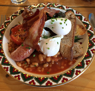

The best breakfast

After breakfast I found my way back down the hill to join the path just east of Kingsand. The first section was through scrubby bushes on low cliffs, then I was soon under the trees on the outskirts of the estate of Mount Edgcumbe. The walking was pleasant in the shade of the trees, with views across Plymouth sound, and hints of what must have once been quite the aristocratic playground dotted along the path.


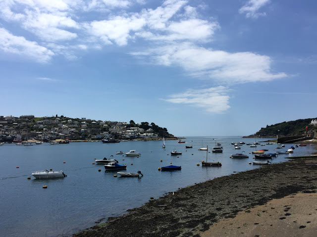
Across the Sound

Another scorching morning

Not far to go!

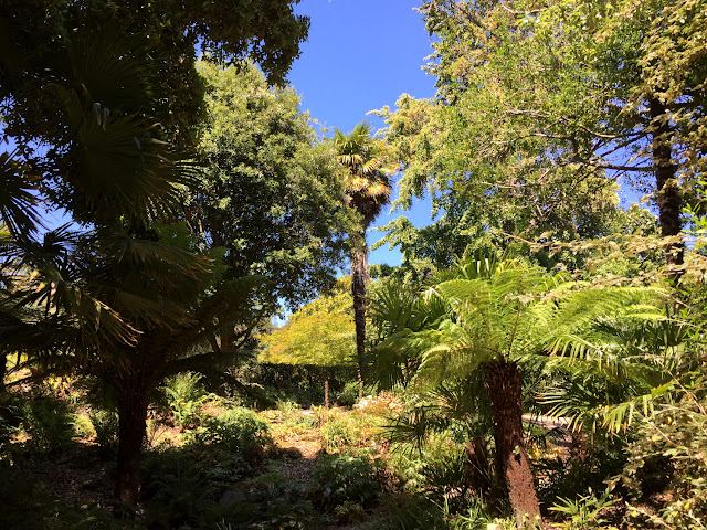
I was soon within the gardens of the estate, which are rather pleasingly free and open to the public. I wasn’t quite expecting formal gardens to be part of the coast path, just shows the variety of the walking! There were plenty of people enjoying the pretty and precisely maintained gardens, and I enjoyed an hour or so wandering round taking too many photos. An ice-cream eaten in the shade of the elegant orangery, and I found my way to the ferry point at Cremyll, past big groups of school kids making use of the wide lawns for outdoor activities. I’m sure the aristocrats that built the house and estate would be horrified at the crowds of ordinary people making use of it, but I was fully delighted by the prettiness of the place and the happy atmosphere.

Giant clams!
Cornish jungle
The orangery at Mount Edgcumbe
Cheerful planting

I took the short ferry ride across to Admiral’s Hard, with plenty of boat traffic for entertainment. I then just had a mile or two to walk through Plymouth, mostly through parks. The day was a very pleasant way to end my walk, and the final ferry ride was a good ending point. Plymouth would also be an easy place to pick up and finish the last 220 miles to Dorset.


Final Ferry

I had intended to complete the walk this Spring, but of course COVID-19 has completely turned the world on its head, and I wasn’t able to go. It has been a welcome distraction re-living my walk, and going back through all the photos. There are many places I can’t wait to revisit, and I definitely intend to complete the path next year. After that, perhaps all the way round the coast of the UK?!


Final stats:

Total days: 43

Rest days: 7

Total distance (approx. according to guidebook): 410.4 miles

Total ascent (approx. according to guidebook): 24,057 metres (nearly 3x Everest!)

Pizzas eaten: 4

Pasties eaten: Countless

Youth hostels: 3 (wish I had discovered them earlier!)

Hotel: 1 (Clovelly)

Campsites: 23

Spending: Approx. £30-£40 a day


Not the finishing photo yet!

Thursday, 16 July 2020

SWCP Day 42: The beginning of the end

Other SWCP posts:

Introduction
Day 1: Minehead to Porlock
Day 2: Porlock to Lynton
Day 3: Lynton to Combe Martin
Day 4: Combe Martin to Mortehoe
Day 5: Rest day, Morte Point loop
Day 6: Mortehoe to Braunton
Day 7: Braunton to Westward Ho!
Day 8: Westward Ho! to Clovelly
Day 9: Clovelly to Hartland Quay
Day 10: Hartland Quay to Morwenstow
Day 11: Morwenstow to Bude
Days 12-14: Bude to Crackington Haven
Day 15: Crackington Haven to Tintagel
Day 16: Tintagel to Port Isaac
Day 17: Port Isaac to Padstow
Day 18: Padstow to Porthcothan
Day 19: Porthcothan to Crantock
Day 20: Rest day, Holywell bay loop
Day 21: Crantock to St Agnes
Day 22: St Agnes to Godrevy
Day 23: Godrevy point to St Ives
Day 24: St Ives to Pendeen Watch
Day 25: Pendeen Watch to Sennen Cove
Day 26: Sennen Cove to Lamorna
Day 27: Lamorna to Marazion
Day 28: Marazion to Porthleven
Day 29: Porthleven to Lizard Point
Day 30: Lizard Point to Coverack
Day 31: Rest day in Coverack
Day 32: Coverack to Maenporth


Day 42

Seaton to Kingsand

Approx. 15 miles (5 by bus), 500m ascent

24,705 steps


I planned an early start to beat some of the heat, but I definitely woke up on the wrong side of the bed that morning. I was still grumpy about the rubbish and expensive campsite, and my feet were back to feeling very painful again. I got packed up and was walking by 7am, feeling groggy and cross about it all. A lot of the day’s walking would be on roads, so I stomped off down the quiet country lane and was soon in Seaton proper, which didn’t seem to be much apart from some holiday lodges and caravans, no chance of a breakfast.


Early morning walking

I found that I could walk along the sea wall instead of carrying on up the road, and was lucky that the tide was out as the path seemed to disappear onto the sand at the end of the concrete wall. I found a cut back up into the village of Downderry, and was able to get some supplies at the post office village shop, no coffee though! My mood was little improved as I continued my trudge along the road through the village, finally finding the path winding up onto the cliff. By this point it was about 8.30 and already getting roasting hot. I stopped in the shade of some big trees to eat a scotch egg, and soon had the company of some bitey horseflies also looking for breakfast.


Another hot day on the cards
Morning haze towards Portwrinkle and Rame head

I hurried on, sore feet not enjoying the steep steps to the top of the hill. Of course the views were stunning, with a vast panorama around Whitsand bay looking towards Rame head. This morning though I was a little oblivious to it. I had soon collected a cloud of horseflies, and as the fierce sun was beating down I huffed and puffed and worked myself up into quite a meltdown on that quiet clifftop, shouting at the flies to sod off, and wildly waving my walking poles, which was entirely ineffective. I stomped on growling and trying to throw them off, and had the sudden realisation that I would end my walk when I reached my sister’s house in Plymouth, now just a few miles away. 


At the end of the military road

My decision to start the walk had been quite spur of the moment, and now my decision to quit was almost instantaneous. Perhaps it sounds a bit pathetic to quit because of a few flies, but I had never intended the walk to be a miserable endurance slog, which was why I was taking my time. Although I had wanted to do it for the physical challenge, I also set out to enjoy exploring the coast, and the constant heat and the flies were making it very unenjoyable. I knew now after completing 400-odd miles that I was perfectly capable of the physical side, but I didn’t just want to slog to the end for the sake of it.


A day of long views

At Portwrinkle I found a cafe with a big terrace that was about to open, so I set myself up on a big table, under the shade of the umbrella, and ordered a bacon sandwich. I chatted to the guy behind the till and told him about the walk and that I had decided to quit, which further confirmed my choice in my head. I sat and considered my plan for the day. I was completely sure of my decision to quit, but I did need to get to Plymouth. The next section of the path was about 4 miles along a road, and as there was a bus option I decided to take it, having no desire to deal with traffic and hot tarmac stomping. I sat and enjoyed the cool shade for a good while, then found the bus and got going again, first to Anthony and a bus change, then alighting a little short of Rame head.


Green cliffs
Rame head topped by the chapel

As I got walking again thankfully the breeze at the headland seemed to be keeping the flies away, so I had an enjoyable walk out to Rame head. The views back along the coast were spectacular, the massive sweep of the bay going on for miles. I took a break in the shade of the little chapel at the head, with plenty of people milling around enjoying the scorching day. The hillside was looking parched and there was the constant buzz of crickets. Just a few miles left to do, although the heat was draining so it was fairly slow going. 


Looking down to Plymouth Sound, big warship
Cawsand

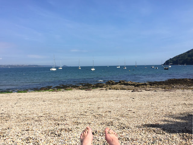
I finally found some shade under trees on the approach to Cawsand, although my feet were protesting again at more tarmac walking. I arrived in the pretty village and found an ice-cream, sitting a while by the beach. It was still sunny and hot, so I decided I would change into my bikini in the village toilets, and go for a swim when I got round the corner to the next door village of Kingsand. On my way I passed a bakery that had a board outside advertising takeaway pizza that evening, so I placed an order for later and went and found a quiet spot on the pebbly beach.


More excellent pizza
Touristing

I had a really rather lovely afternoon, taking a dip in the mild sea and enjoying watching families messing about on boats. The pizza was excellent, eaten with a careful eye on the local gull population. I then found my way up the hill to the campsite for the night, in an unusual setting on an old military base (Maker campsite). I was excellent, with very spaced out pitches cut into the long meadow grass (and cheaper than the previous night!). I found a perfect spot looking towards the setting sun and with a view down towards Plymouth. It had been a challenging day, but I was 100% sure of my decision to end the walk, and with all the pressure of another 200 miles removed, I was feeling very calm and relaxed.


The interesting campsite
Pitch with a view down to Plymouth
Tent flap sunset

Saturday, 11 July 2020

SWCP Day 41: Sunday strollers

Other SWCP posts:

Introduction
Day 1: Minehead to Porlock
Day 2: Porlock to Lynton
Day 3: Lynton to Combe Martin
Day 4: Combe Martin to Mortehoe
Day 5: Rest day, Morte Point loop
Day 6: Mortehoe to Braunton
Day 7: Braunton to Westward Ho!
Day 8: Westward Ho! to Clovelly
Day 9: Clovelly to Hartland Quay
Day 10: Hartland Quay to Morwenstow
Day 11: Morwenstow to Bude
Days 12-14: Bude to Crackington Haven
Day 15: Crackington Haven to Tintagel
Day 16: Tintagel to Port Isaac
Day 17: Port Isaac to Padstow
Day 18: Padstow to Porthcothan
Day 19: Porthcothan to Crantock
Day 20: Rest day, Holywell bay loop
Day 21: Crantock to St Agnes
Day 22: St Agnes to Godrevy
Day 23: Godrevy point to St Ives
Day 24: St Ives to Pendeen Watch
Day 25: Pendeen Watch to Sennen Cove
Day 26: Sennen Cove to Lamorna
Day 27: Lamorna to Marazion
Day 28: Marazion to Porthleven
Day 29: Porthleven to Lizard Point
Day 30: Lizard Point to Coverack
Day 31: Rest day in Coverack
Day 32: Coverack to Maenporth


Day 41

Polperro to Seaton

Approx. 8 miles, 550m ascent

19,435 steps


We managed to get up at a reasonable hour and get the caravan packed up, then headed to Looe to leave the vehicles, with a taxi back to the path at Polperro. Polperro was nice a quiet on that grey morning; quite a contrast to the sunny afternoon the day before. We made our way back down to the harbour and found the path edging around the entrance and back out onto the cliff. The low green cliffs made for very pretty walking, and we were soon in the little bay at Talland, with crystal clear water showing the red stony seabed below.


A cooler morning
Looking towards Talland
Clear seas

Around the next headland we were in sight of Looe island, standing prominently a little way offshore. The path was fairly easy going today, with only a few small valleys to contend with, and thankfully much cooler that the previous day, with a blanket of cloud lying low above us. We were soon approaching Looe and finding the Sunday strolling crowds, with a veritable queue to get up the last small hill on the approach to the town. 


Green cliffs
Lugger regatta

The bay was filled with square-sailed boats, and it became clear we had coincidentally timed our walking to coincide with the Lugger Regatta. The event celebrates the fishing heritage of the area, with many two-masted traditional Lugger sailing boats taking part. Around the final little headland and we were in suburbia, along the long approach road into Looe proper. The harbour was filled with boats and many people but we weaved our way through and found the car and a nearby pub for lunch. 


Looe harbour front
Not real unfortunately!

After another excellent ice-cream I was re-united with my big backpack, and parted ways with my Aunt and Uncle who were now heading back home. I had another couple of miles to cover to find my campsite for the night, just short of Seaton. I made my way back to the harbour front and wandered around a little trying to find the path up the cliff, finally getting pointed in the right direction by a fellow path-walker. The couple of miles left to walk weren’t very exciting, mostly following residential roads on the outskirts of Looe, then lanes and finally a quiet tree-lined road to avoid a recent landslip.


Heading through Looe

Those last couple of miles were not enjoyable walking. I was too full and tired from an over-sized lunch, and the sun had come out so I was very quickly overheated again. Having the big pack back on was a bit of the shock to the system after several days without it, and the bitey flies were back too. Grumble grumble. 


On arriving at my campsite I quickly realised I had made a bad choice, but without any real alternative I had to stay put (I wish I was brave enough to wild camp!). I had called ahead and all sounded fine, but it looked like it was a CC club site and was therefore very expensive for me as a non-member. There was no one around when I arrived so I called the reception number again and the owner I spoke to seemed very grumpy, although did point me to which pitch to use. I pitched and used the showers, which weren’t too bad although in a somewhat a spider-filled shed. When I got back to the tent the site had been invaded by sheep so there was plenty of muck on the ground. I didn’t see the owner all evening, so wondered if I wouldn’t need to pay, but going for a last pee at 11pm I was accosted by the caretaker who was very glad to relieve me of £15 for the night; the most expensive site since Porthleven!

Monday, 6 July 2020

SWCP Day 40: Hotter than hell

Other SWCP posts:

Introduction
Day 1: Minehead to Porlock
Day 2: Porlock to Lynton
Day 3: Lynton to Combe Martin
Day 4: Combe Martin to Mortehoe
Day 5: Rest day, Morte Point loop
Day 6: Mortehoe to Braunton
Day 7: Braunton to Westward Ho!
Day 8: Westward Ho! to Clovelly
Day 9: Clovelly to Hartland Quay
Day 10: Hartland Quay to Morwenstow
Day 11: Morwenstow to Bude
Days 12-14: Bude to Crackington Haven
Day 15: Crackington Haven to Tintagel
Day 16: Tintagel to Port Isaac
Day 17: Port Isaac to Padstow
Day 18: Padstow to Porthcothan
Day 19: Porthcothan to Crantock
Day 20: Rest day, Holywell bay loop
Day 21: Crantock to St Agnes
Day 22: St Agnes to Godrevy
Day 23: Godrevy point to St Ives
Day 24: St Ives to Pendeen Watch
Day 25: Pendeen Watch to Sennen Cove
Day 26: Sennen Cove to Lamorna
Day 27: Lamorna to Marazion
Day 28: Marazion to Porthleven
Day 29: Porthleven to Lizard Point
Day 30: Lizard Point to Coverack
Day 31: Rest day in Coverack
Day 32: Coverack to Maenporth

Day 41: Polperro to Seaton

Day 42: Seaton to Kingsand

Day 43: Kingsand to Plymouth


Day 40

Polruan to Polperro

Approx. 7 miles, 550m ascent

16,190 steps


The evening after the James Acaster show I headed back down to Cornwall with my Aunt. My Uncle travelled separately on his motorcycle, so that we could use the two vehicles to shuttle from the start and end of the 2 days’ walking we had planned. We stayed in a rather fancy static caravan (things have moved on from lurid patterned upholstery!), on a big site a couple of miles inland from Polperro. The caravan would be the base for a couple of days, giving me a couple of easy days of walking without the big backpack.


On Saturday morning after a leisurely breakfast we drove down to Polruan to start the walk, just on the other side of the estuary to Fowey. We planned a relatively short distance to ease them in gently, but the section did have quite a few decent valleys, so it wouldn’t be too easy, and was certainly a good part to walk for an accurate introduction to the path! After taking in the stunning views up the estuary we found our way out to the clifftop path. The path traced the high green cliffs, with spectacular long views up and down the coast.


Looking back across the water to Fowey
Stunning views along the coast

The day started with a few wispy clouds resting in the sky, but it soon heated right up, and was tough going on the exposed cliffs. The horseflies seemed to have a taste for my Aunt, who was somewhat plagued by them in the warm morning air. However, the beautiful section was a very pleasant walk, and I was glad to be feeling strong and fast after a couple of good rest days and only a small backpack.


More pretty little bays and coves

After a very hot morning of walking, we hauled ourselves up a particularly steep hill and found a perfectly placed bench with a pleasant breeze for a lunch stop. We were very shortly overtaken by a woman running up the very steep path, which put us all to shame as we got our breathe back. We enjoyed our lunch picnic, although the complete lack of shade was a bit much for me, and I was pleased to have remembered my silly floppy hat to keep the sun off my face.


Snaking path on the left of shot

The afternoon was tough going, with no let up in the steaming weather and not much breeze to take the edge off. I was rather pleased we agreed to only 7 miles, as that was plenty in such conditions; I am not built for the heat! Finally with a mile or so to Polperro the path found some shade in the trees and high hedgerows and the air was filled with the lovely scent of warm privet flowers. I love that smell; when we were children there was an odd section of privet hedge in the middle of our garden, and we frequently used it to build dens to laze around under on hot summer days.


Polperro harbour

We rounded the corner into very pretty Polperro, and enjoyed a good while exploring the little twisting streets. We discovered some very excellent proper ice-cream, and revived ourselves in the shade. To get back to the caravan we had planned to catch a bus, but as we walked up through the village to the bus stop a taxi passed us and was happy to stop and pick us up. I made the most of the caravan facilities whilst my Aunt and Uncle jumped on the motorbike to collect the car. After they returned we found a nice local pub for dinner, and I ate far too much delicious food, continuing to eat my way around the whole of the South West!


Pretty Polperro


Thursday, 2 July 2020

SWCP Days 37-39: A comedic interlude

Other SWCP posts:

Introduction
Day 1: Minehead to Porlock
Day 2: Porlock to Lynton
Day 3: Lynton to Combe Martin
Day 4: Combe Martin to Mortehoe
Day 5: Rest day, Morte Point loop
Day 6: Mortehoe to Braunton
Day 7: Braunton to Westward Ho!
Day 8: Westward Ho! to Clovelly
Day 9: Clovelly to Hartland Quay
Day 10: Hartland Quay to Morwenstow
Day 11: Morwenstow to Bude
Days 12-14: Bude to Crackington Haven
Day 15: Crackington Haven to Tintagel
Day 16: Tintagel to Port Isaac
Day 17: Port Isaac to Padstow
Day 18: Padstow to Porthcothan
Day 19: Porthcothan to Crantock
Day 20: Rest day, Holywell bay loop
Day 21: Crantock to St Agnes
Day 22: St Agnes to Godrevy
Day 23: Godrevy point to St Ives
Day 24: St Ives to Pendeen Watch
Day 25: Pendeen Watch to Sennen Cove
Day 26: Sennen Cove to Lamorna
Day 27: Lamorna to Marazion
Day 28: Marazion to Porthleven
Day 29: Porthleven to Lizard Point
Day 30: Lizard Point to Coverack
Day 31: Rest day in Coverack
Day 32: Coverack to Maenporth


Day 37-39

Polkerris to Fowey, 2 rest days

Approx. 5 miles, 250m ascent

16,359 steps


Today I was on a mission. Several months ago I had bought tickets for me and the boyfriend to see the comedian James Acaster in Weymouth, and tomorrow night (Thursday) was the night. Today I needed to walk to Fowey, then get the bus back to the mainline train station at Par, catch a train to Plymouth to meet my Mum, who had kindly agreed to then ferry me back to Dorset for the big night out. I would take a couple of rest days in Dorset, then back to the path on Saturday, this time with my Aunt and Uncle for company.


Towards Gribbin head
Back across St Austell bay

Knowing I only had 5 miles to walk, I felt very relaxed and able to take my time over the path. I headed out towards Gribbin head, easy to spot with the landmark of Gribbin tower looming above the landscape. The low cliffs gave excellent views back across St Austell bay in the morning sun, and I was soon at the head and in the shadow of the candy-striped tower. I didn’t linger too long though as the horseflies seemed to be back, so I got on with heading back down the hill and found the pretty little bay at Polridmouth, which the guidebook tells me is said to have inspired the setting for Daphne du Maurier’s “Rebecca”.


Gribbin tower
Not far to Fowey!
Polridmouth

The path dipped in and out of a couple of valleys, and I was soon on the outskirts of Fowey at the curiously named Readymoney, another very pretty cove. Onwards up the estuary along the high esplanade road, past many big expensive houses with their perfect views down to the busy river below. I found my way in to the town centre and had an explore of the river front, then located a suitable lunch establishment and enjoyed people-watching in the bustling little town.


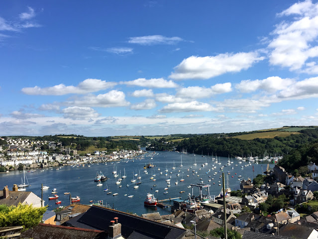
Looking up the Fowey estuary
I'd miss this ferry crossing as we'd start walking the next section on the other side
Plenty of boats

After lunch I found the bus stop to Par, and after a 20 minute ride (it took me a lot longer to walk it!) I was at the train station and awaiting my train to Plymouth. The train journey was pleasant, with many high bridges cutting high over valleys, and it was quite the novelty to be travelling so fast after so long at walking pace.